In the 1700s, the city of Rome became a hub for rich European tourists eager to see the ruined monuments of ancient Rome. This revitalized Rome's economy and the city blossomed with new development. This rich tourism market allowed mapmakers to create some of the earliest most detailed city maps in the history of cartography. 

Of note, the mapmaker Giambattista Nolli created the most detailed map of Rome that had ever existed until that point, detailing hidden alleys, the insides of churches and buildings, garden paths, and even the ruins of ancient Rome's dilapidated bridges. Using his map as the basis, this projects seeks to recreate the city through his eyes, and those of other mapmakers; notably Giovanni Battista Falda and Giuseppe Vasi. Using their work, this project will recreate the city of Rome and its surrounding countryside in 1:1 scale.

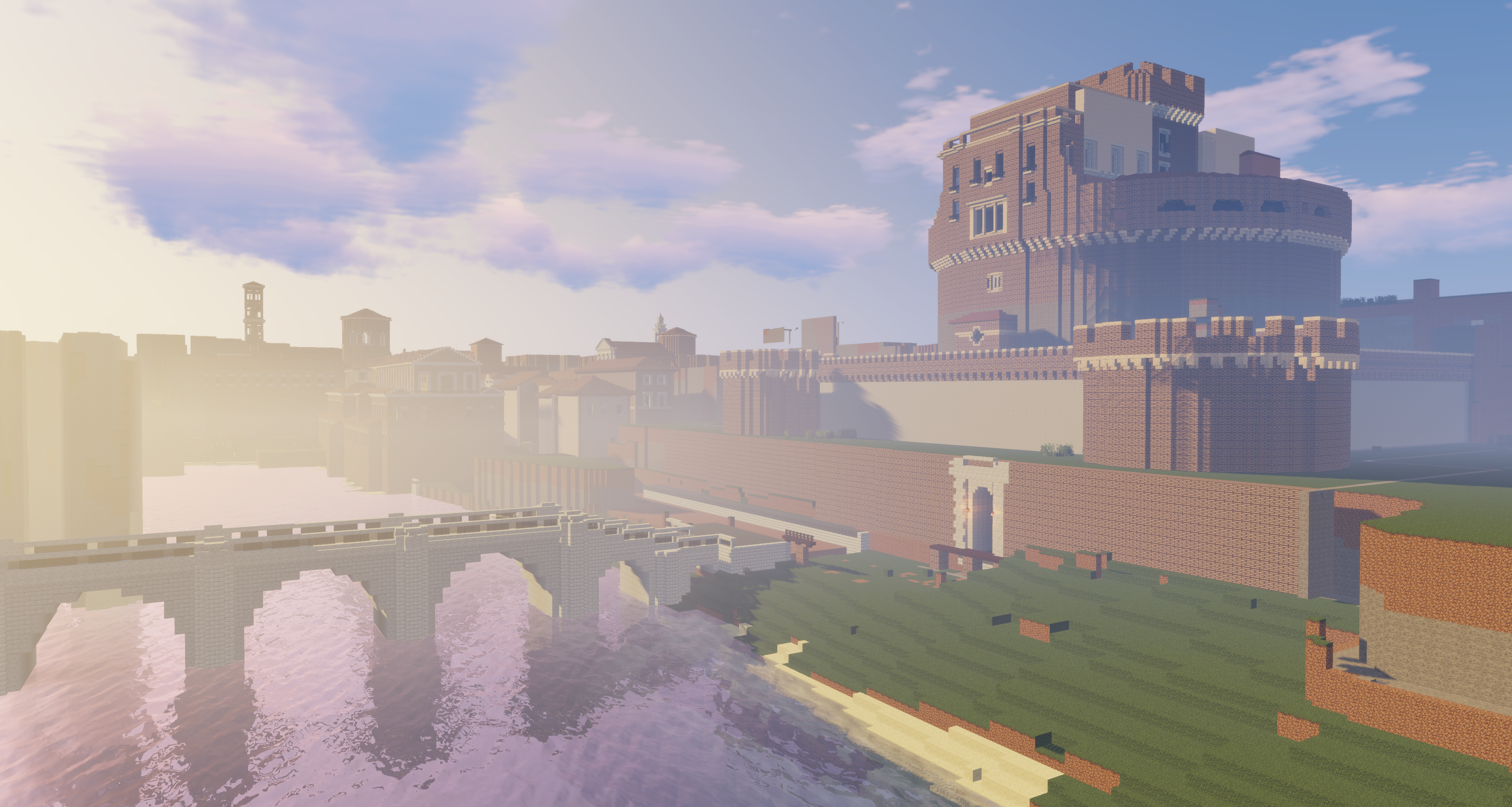
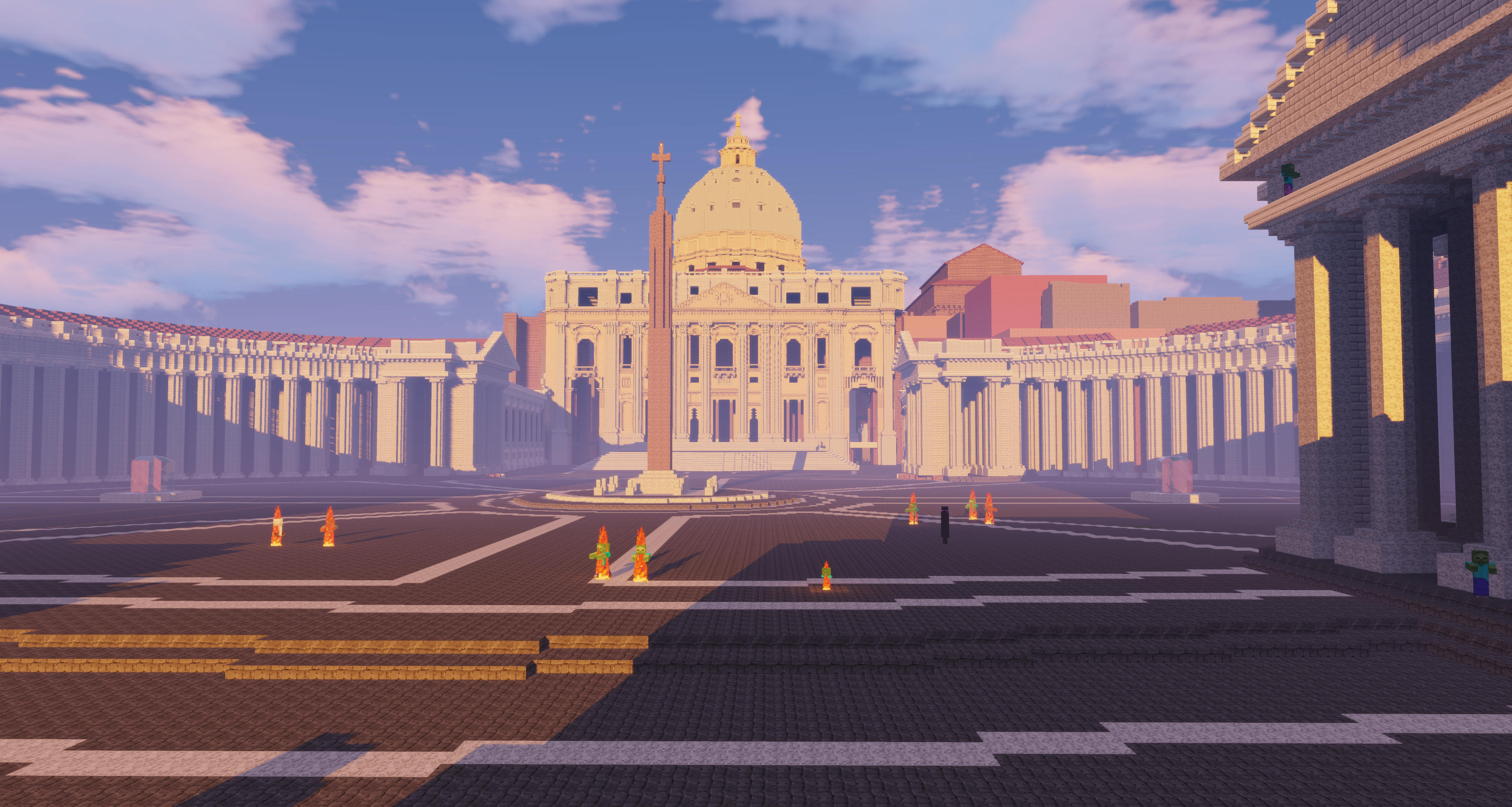
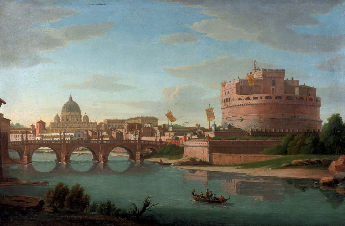
Rendered view of the Castel Sant'Angelo and Caspar Van Wittel's view of the Vatican (1700-1736)

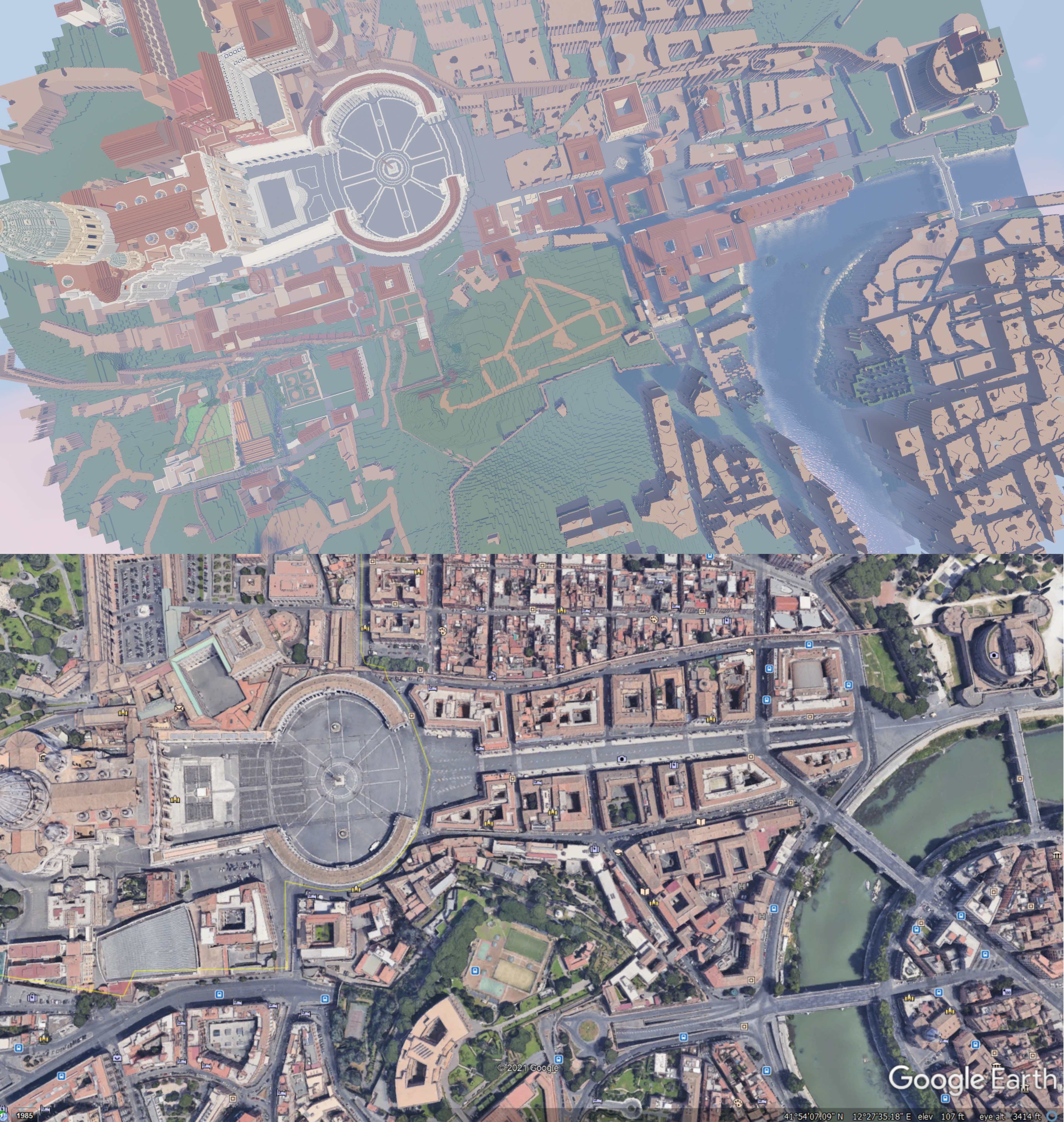
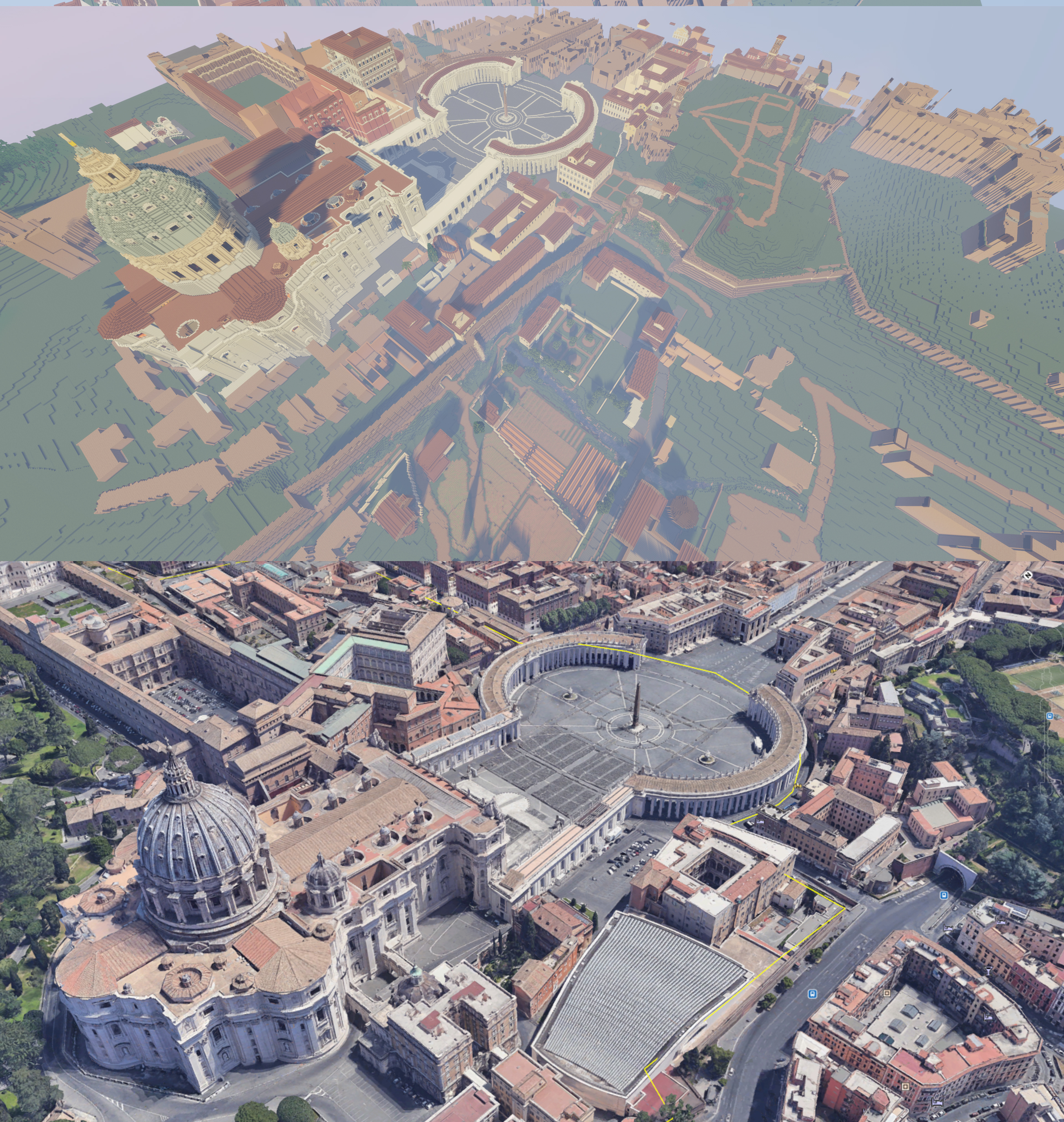
Aerial view of the walled city

Taken from WorldPainter, a custom map editor for Minecraft that allows heightmaps to be imported. Essentially this software creates an outline of the city to be built on top of. 

8-month project

this black and white heighmap combines both GIS DEM data of the metropolitan city of Rome with Nolli's 1750 map of Rome to create a 'basemap' on the left. 

SANTO SPIRITO COMPLEX
Neighborhood of Chiesa Santo Spirito, Ospedale Santo Spirito, Palazzo del Conservatore, Palazzo della Rovere, Palazzo Serristori, Palazzo Cesi
the images below are not representative of a final product but rather to illustrate some methodological points. 

Accessioning system

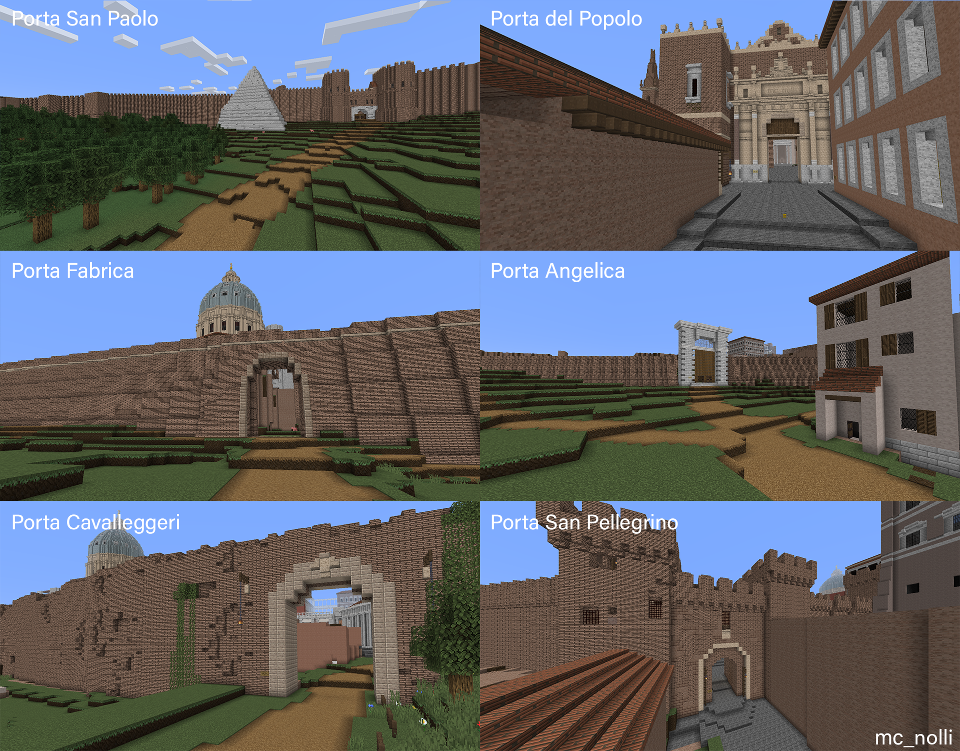
each major landmark that can be crossreferenced to Nolli's Map is given that number at its entrance.

1238 marks the church of the holy spirit (Chiesa Santo Spirito) 

creative liberties were taken to keep major landmarks from being built at an angle, but rather at 90* as often ass possible

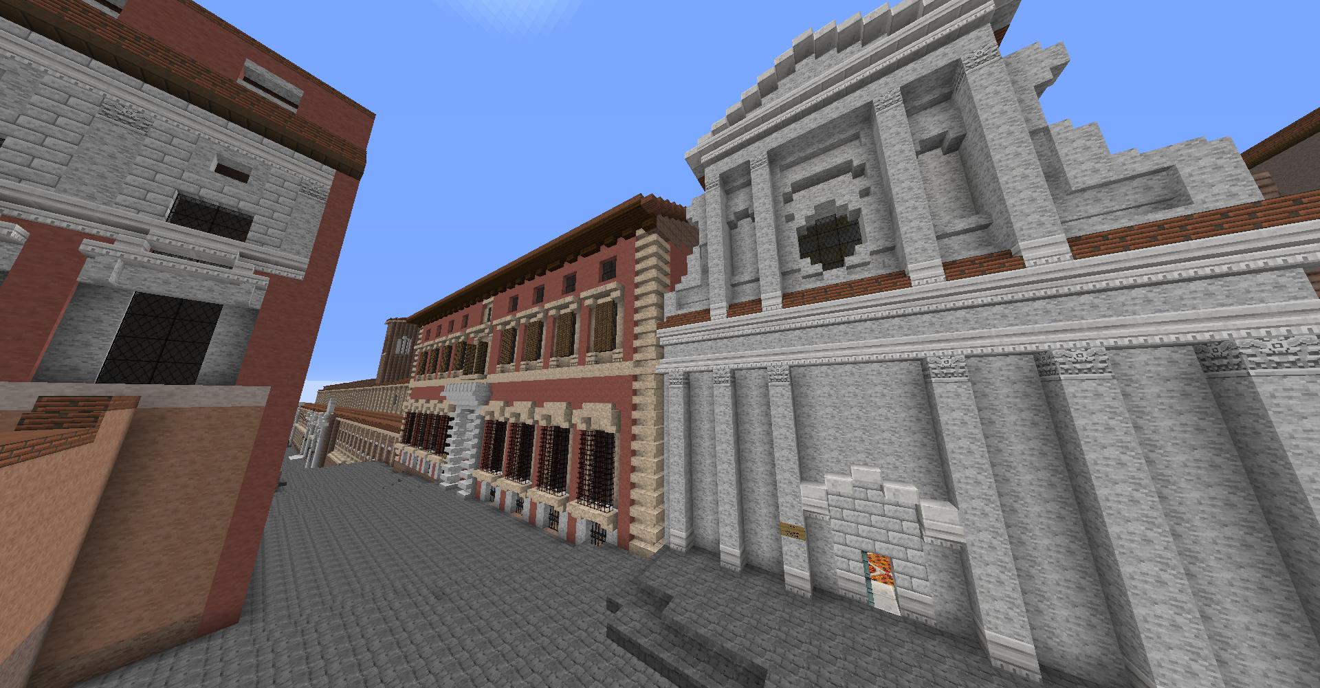
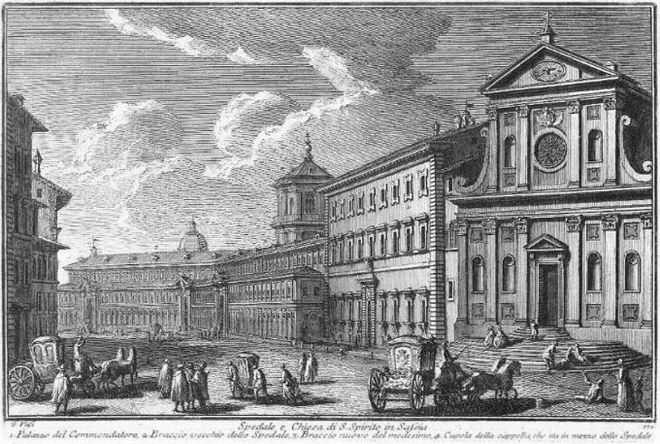
Screenshot taken at the angle of Vasi's vedute on the right. Note the expanded wing of the Ospedale Santo Spirito which was recently built in the 1750s and removed in the 19th century. 

While Vasi's view and Nolli's map are the most important referenced works, much of the city still exists as it did in 1750 and Google Earth/Maps can prove an invaluable data set. 

VATICAN RECREATION AS OF APRIL 2021
Comparison with Google Eath Imagery
Gates of Rome
References and Acknowledgements
A special thank you to Roberto Piperno who created RomeArtLover. The best guide to the early modern city of Rome. http://www.romeartlover.it/index.html 
as well as to the Churches of Rome Wiki. https://romanchurches.fandom.com/wiki/Main_Page
Imago Urbis: Giuseppe Vasi’s Grand Tour of Rome. Jim Tice, Erik Steiner, Allan Ceen, and Dennis Beyer. Department of Architecture and InfoGraphics Lab, Department of Geography, University of Oregon. Copyright © 2008 University of Oregon. All rights reserved. http://vasi.uoregon.edu/index.htm
The Nolli Map Website. © 2005-2021 University of Oregon. Jim Tice, University of Oregon Dept of Architecture. Erik Steiner, InfoGraphics Lab, Dept of Geography. Consulting: Allan Ceen PhD., Penn State/Studium Urbis. Jim Tice, University of Oregon Dept of Architecture. Erik Steiner, InfoGraphics Lab, Dept of Geography. Consulting: Allan Ceen PhD., Penn State/Studium Urbis. http://nolli.uoregon.edu/credits.html
UC Berkeley Library. La nuova topografia di Roma Comasco by Giambattista Nolli, ca 1692-1756. Copyright © 2009 The Regents of the University of California. All rights reserved. Document maintained on server by: Earth Sciences & Map Library
Last updated 7/24/2009.  https://www.lib.berkeley.edu/EART/maps/nolli.html 
Wikimedia Commons. Nuova Topografia di Roma di Giovanni Battista Nolli (1748). https://commons.wikimedia.org/wiki/Nuova_Topografia_di_Roma_di_Giovanni_Battista_Nolli_(1748)
Wikimedia Commons. Vedute by Giovanni Giacomo de Rossi. https://commons.wikimedia.org/wiki/Category:Il_Nuovo_Teatro_delle_Fabbriche,_et_Edificii,_in_Prospettiva_di_Rome_Moderna_-_Book_III_(1667-1669)_by_Giovanni_Giacomo_De_Rossi
St. Paul's Outside the Walls: A Roman Basilica, from Antiquity to the Modern Era [Book] Nicola Camerlenghi
Scalar at USC. The Digital Piranesi. https://scalar.usc.edu/works/piranesidigitalproject/vedute-di-roma-opere-vol-17?path=index
Historic Maps of Rome. National Gallery of Art. The History of the Accademia di San Luca, c. 1590–1635: Documents from the Archivio di Stato di Roma. https://www.nga.gov/accademia/en/maps.html
A Digital Extension of a Roman Cartographic Classic: The 1748 Nolli Map and its Legacy. James Tice. Journal 18. https://www.journal18.org/issue5/a-digital-extension-of-a-roman-cartographic-classic-the-1748-nolli-map-and-its-legacy/
Bibliotheca Hertziana, Fotothek. Views from Giuseppe Vasi's work. http://foto.biblhertz.it/exist/foto/i-raraview.xq?bhr=Dg+536-3470/2+gr+raro
Stanford Libraries. Archaeology in Rome through the photographs of Rodolfo Lanciani.  https://exhibits.stanford.edu/lanciani/feature/archaeology-in-rome-through-the-photographs-of-rodolfo-lanciani
Princeton University Libraery Catalogs. © 2021 The Trustees of Princeton University. All rights reserved. (see below)
Palaces of Rome: https://catalog.princeton.edu/catalog/2064429#view
Gardens of Rome: https://catalog.princeton.edu/catalog/2070964#view
Fountains of Rome: https://catalog.princeton.edu/catalog/2078159#view
Vatican Museums VR Tours. https://www.vatican.va/various/basiliche/san_pietro/vr_tour/index-en.html
lightobject on Flickr, historical images of Rome. https://www.flickr.com/photos/55364579@N05/galleries/with/72157630602059292
Edifices de Rome moderne. Uploaded by LisaEgge on October 14, 2009. https://archive.org/details/dificesderomem03leta/page/n7/mode/2up
Collection of works by Ettore Roesler Franz. (Italian, 1845–1907) http://www.artnet.com/artists/ettore-roesler-franz/
Harvard Library Viewer. Vedute by Giovanni Battista Falda (1640-1678) https://iiif.lib.harvard.edu/manifests/view/drs:460150343$8i
Piraneseum.com featured maps https://www.piraneseum.com/artwork/giuseppe-vasi/
Blue Mountain Project. The Mask Volume 11, Number 1, January 1925. Detailed annotations of Nolli's map. https://bluemountain.princeton.edu/bluemtn/?a=d&d=bmtnaau192501-01.2.6&
Musei Capitolini VR Tours. https://tourvirtuale.museicapitolini.org/
GIS Data referenced from the Geoportale Nazionale and terrain.party. http://www.pcn.minambiente.it/viewer3D/

You may also like

Back to Top