The Catalina Island Archaeological Project
this sub-project is part of a grander Catalina Island Archaeological Project. In collaboration with Abbrianah Aiken, this project seeks to reconstruct Eagles' Nest Hunting Lodge on Catalina Island in 3 distinct time periods: the 1920s, 1970s, and a final photogrammetric captured completed by USC Archaeology in 2018. We also created a conceptual museum room which preserves the space of the hunting lodge, without textures, and pediments which showcase photogrammetric captures of artifacts that were excavated at the site and are currently house at the USC Archaeology Lab.
Methodology
Phase 1: Architectural Reconstruction on RHINO
Using architectural plans, Abriannah Aiken reconstructed the site to specific architectural specifications. This model was exported to Maya. Because Rhino's applications are mainly architectural, I used Autodesk Maya to lower the polygon count, clean the mesh, and texture the model.

Architectural Model within RHINO's viewport (interior)
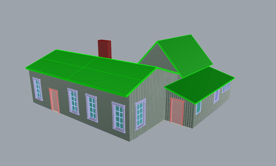
Architectural Model within RHINO's viewport (exterior)
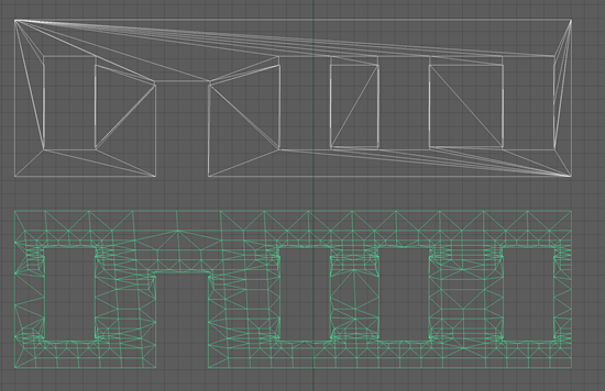
Phase 2: Mesh Clean up
Lowering polygon counts reduces lag in VR settings immensely. Clean models are also less likely to become corrupt as long as an object's history is deleted when finished.
During this stage I was able to reduce the polygon count of the model by over 80% while preserving all the faces' proportions.
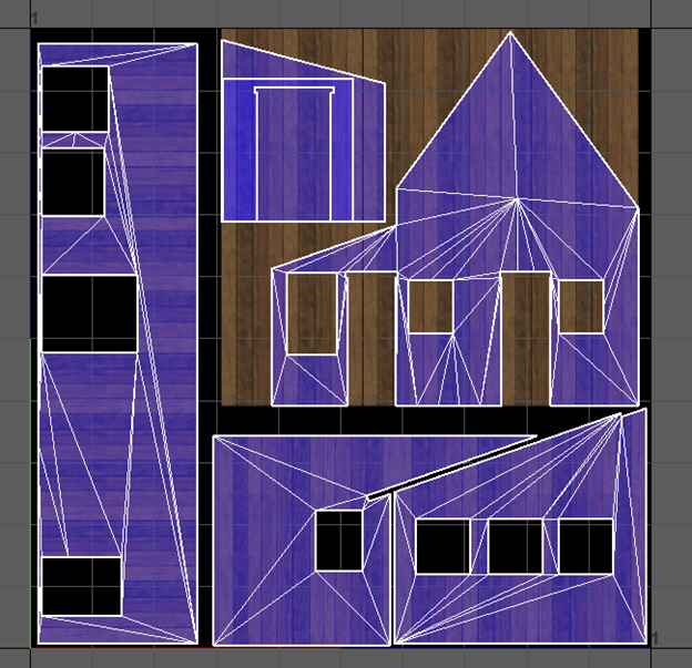
Phase 3: Texturing
Some models (mostly furniture) had to be remodeled in Maya to allow them to be textured. The texture process for both the furniture and the site was done by sampling historical and modern images of the site to assure that colors were represented authentically. Examples of measures taken include counting boards per wall face at the extant site.
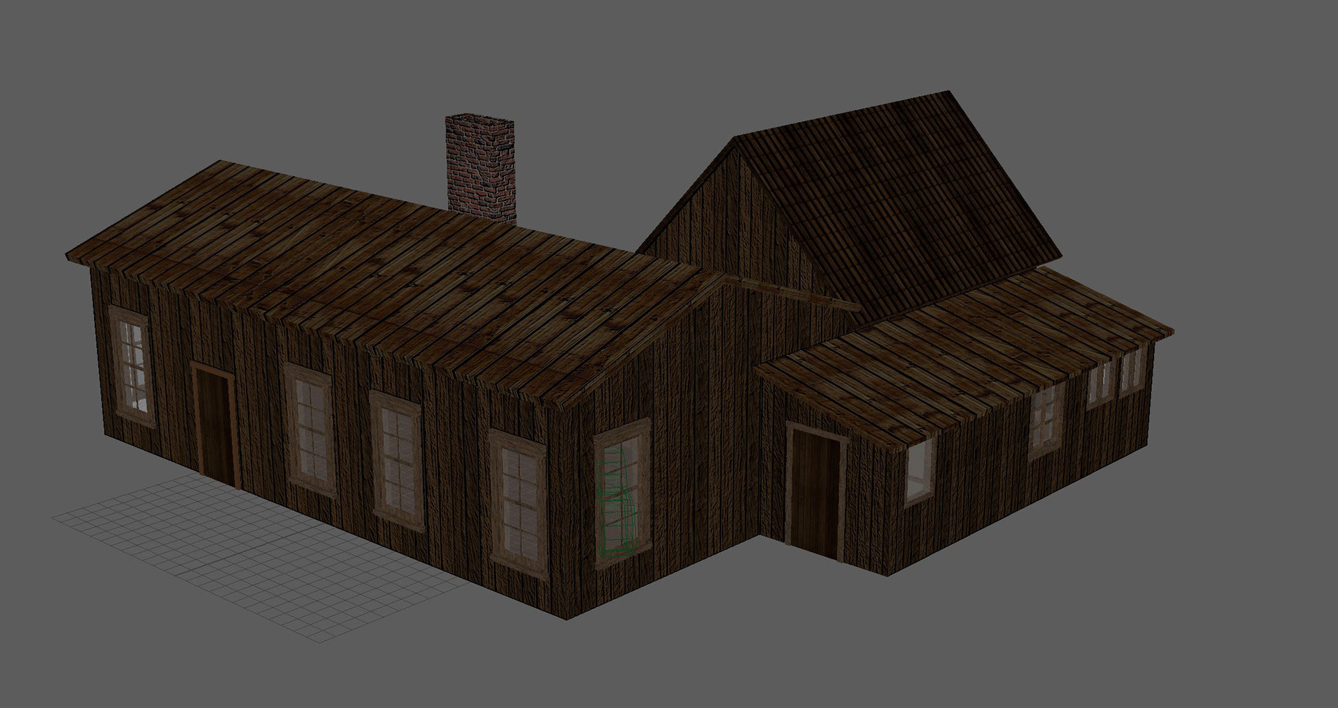

Phase 4: Modeling and Texturing Assets based on contemporary photography

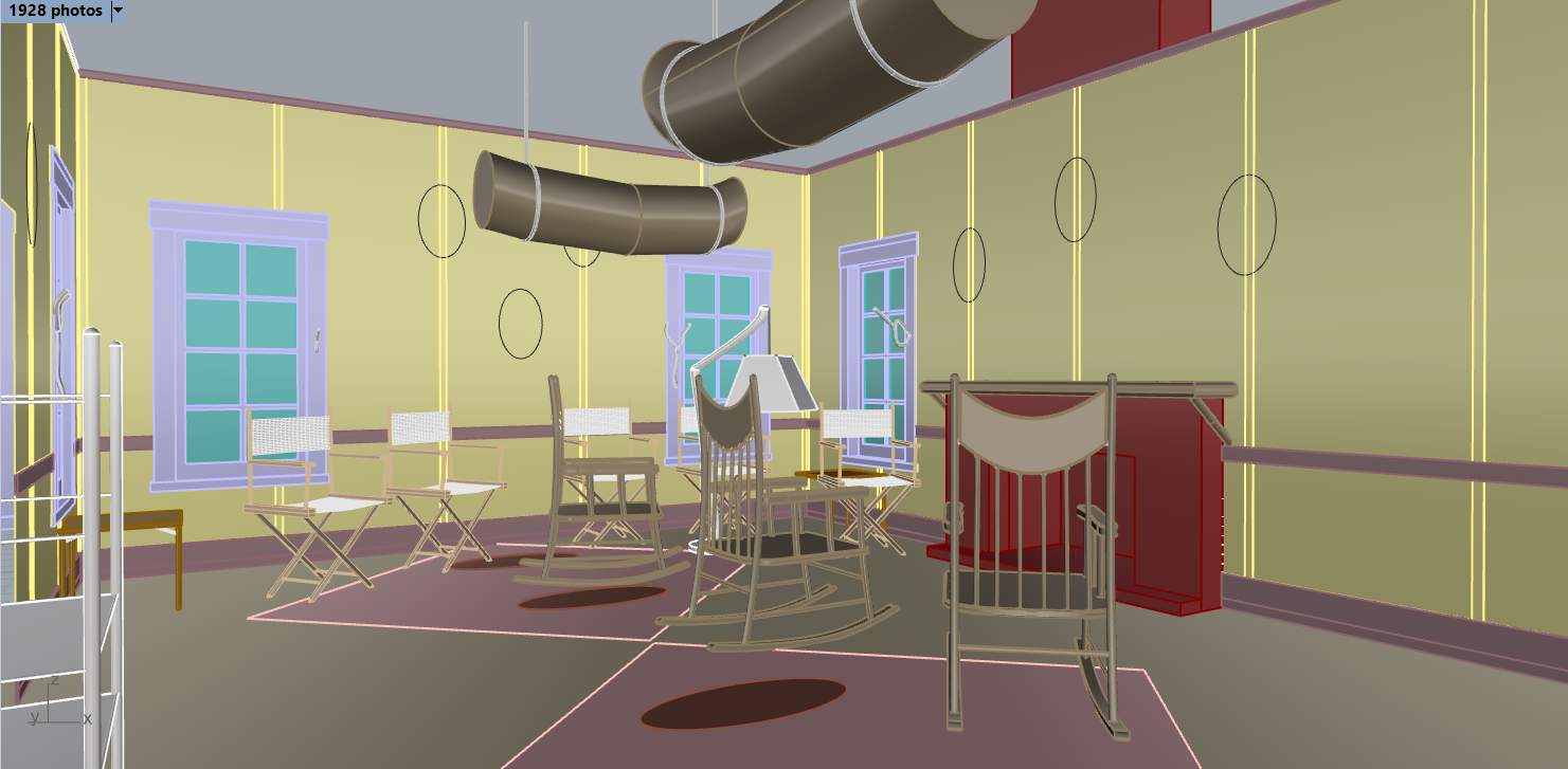
Using only the photograph on the right, we reproduced this interpretation of the main living room. Texture colors were sampled from local wood variants.
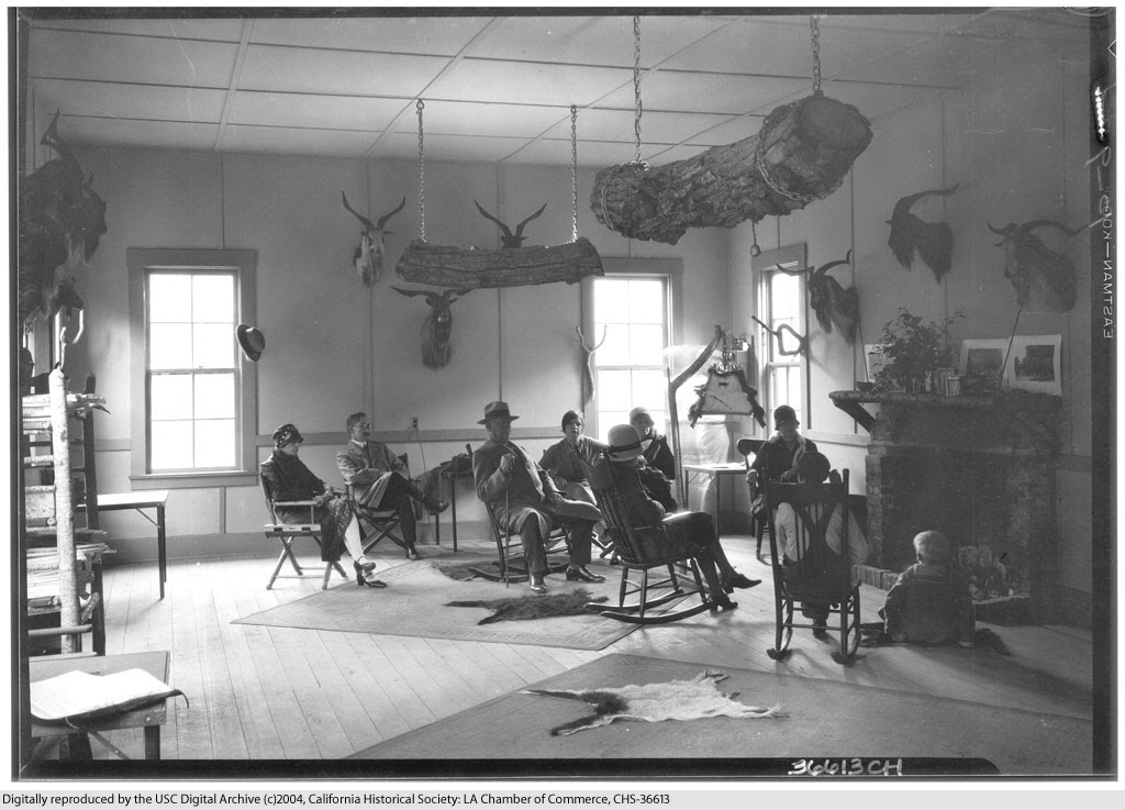
Reference photo courtesy of the California Historical Society, dated 1928.
using reference images as textures
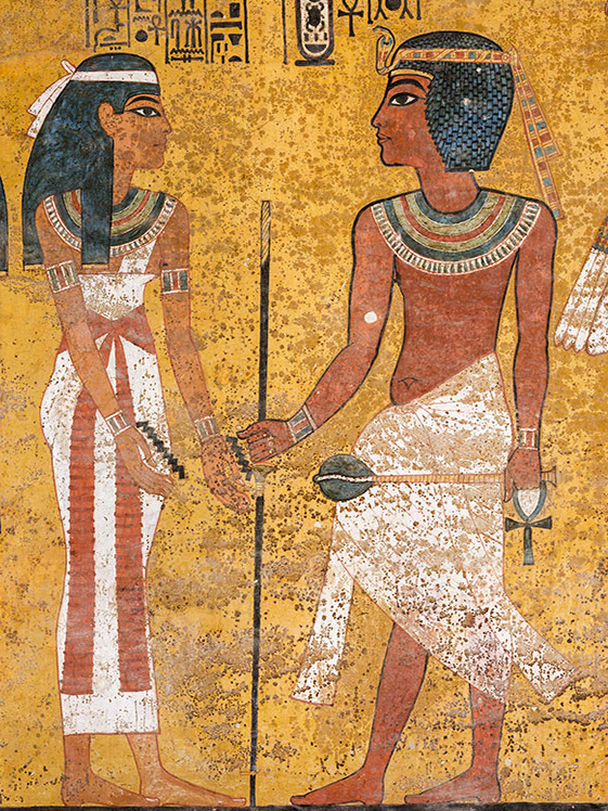
sometimes it is possible to directly use a photograph to recreate this artifacts digitally. Not dissimilar to photogrammetry, this process allows a texture artist to extremely accurately reproduce objects like the ones below. Note that while the textures is an exact replication of the writing in both artifacts, the artifacts themselves vary from the ones pictured and are not exact reconstructions


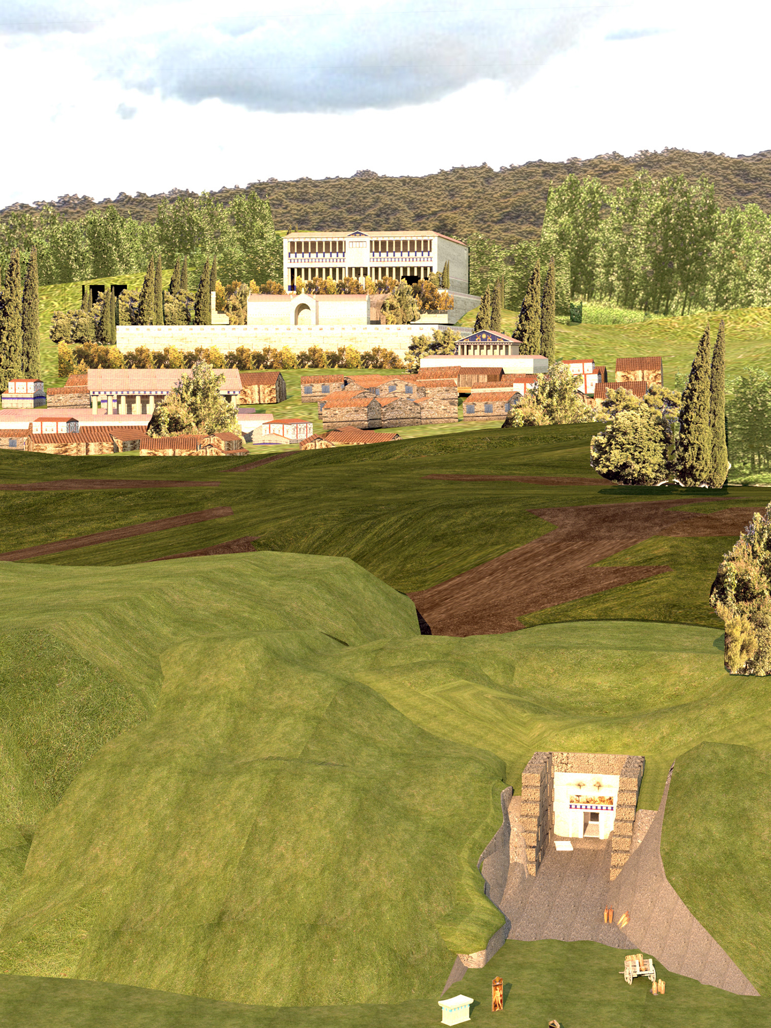
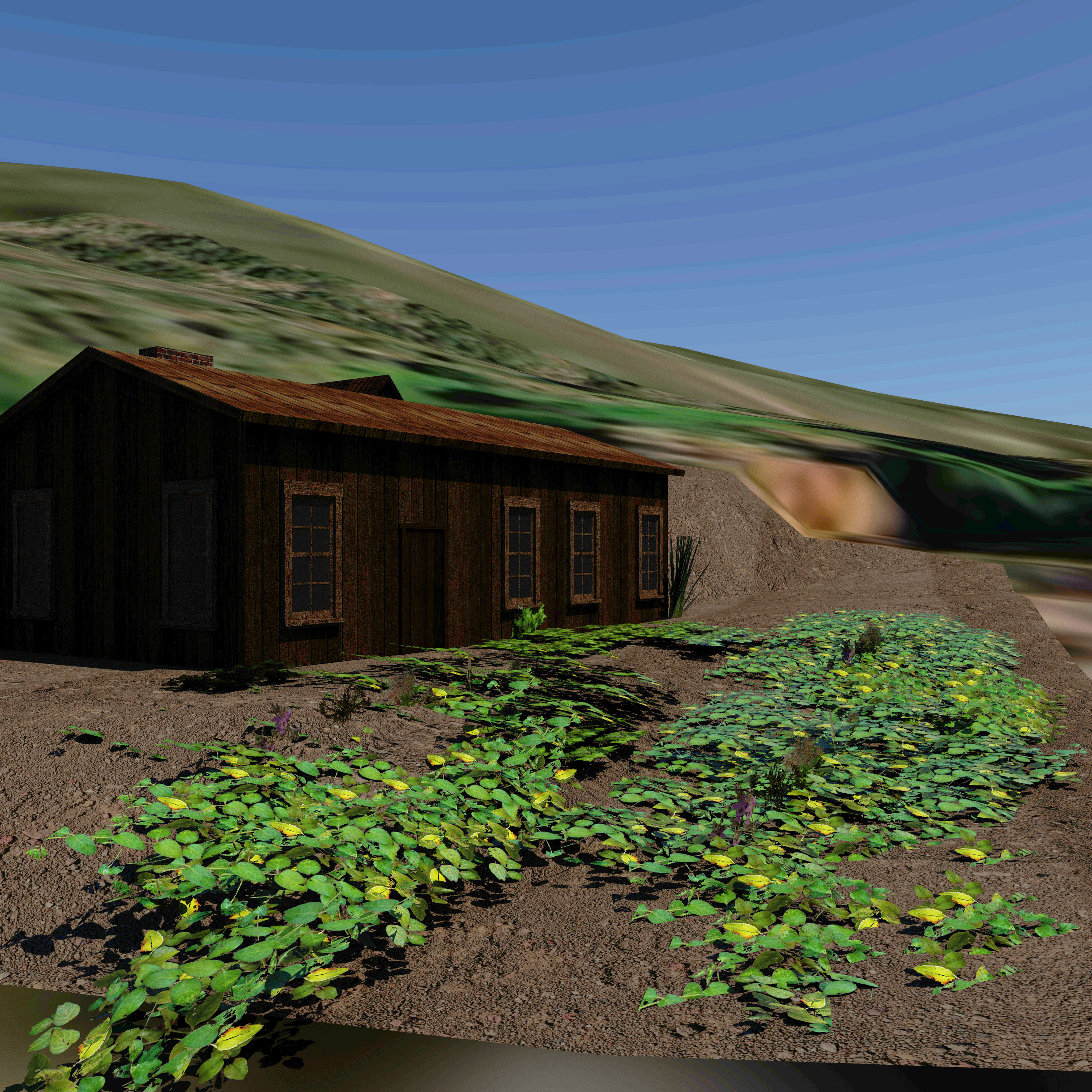
Phase 5: Naturalism & GIS Update
While recreating a model of a space is a very common practice, it can sometimes feel abstracted and out-of-context, I wanted to explore this by seeking to situate the model in a similarly researched version of its natural environment. I wanted to explore the idea that the setting of a historical model can be contextualized by recreating the natural environment where it is situated. To do this, I used the application "iNaturalist" where users upload photos of endemic fauna and animals, these photos are uploaded with GPS coordinates, and can be designated as "Research Grade." I compiled different species within a one-mile radius of the site and used photoshop to create abstract textures based on these findings. It should be noted that natural spaces are dynamic, and these species may vary from what may have existed in the 1920s and before. However, it does situate the site in a natural environment more authentic than a randomly generated collection of trees and other plant species. DEM terrain data from Google Earth was used to recreate the terrain model and texture of the site as well.


A generic soil texture was used to create an HD soil texture, it was however color corrected to match the soil color found near the area. This was done by placing a small picture of the soil from the photogrammetric capture and color matching it the HD texture to this photographed soil sample.